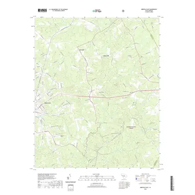
2020 Map of Abbeville East
USGS Topo · Published 2020About this map
The eastern outskirts of Abbeville give way to a landscape defined by the drainage basins of Long Cane Creek and Big Curtail Cr. This modern survey illustrates the transition from the municipal center to the expansive timberlands of the Sumter National Forest. The map is particularly detailed regarding recreational and rural infrastructure, noting the Long Cane Horse Trl N Lp and the Cedar Springs Ohv Trail winding through the woodland south of Morton Bridge. Local heritage is anchored by a significant number of family and community burial grounds, including Aiken Cem in the north and Big Adams Cem near the eastern boundary. The presence of Darraugh and Millers Mill suggests long-standing rural nodes, while the Abbeville Airport marks the modern transportation footprint for the region. Historical road patterns remain visible via the Old Abbeville Hwy and Old Douglas Mill Rd.
Find a feature on this map
107 named features on this map. Tap any name to fly to it.
Don’t see what you’re looking for? This feature index may not catch every label — zoom into the map to look around manually.
Map Details
Editions of this 2020 Abbeville East Map
This is the sole edition of this map. No revisions or reprints were ever made.
Other maps of this area

1892 · Abbeville
USGS Topo · 1:125,000

1948 · Abbeville East
USGS Topo · 1:24,000

1948 · Verdery
USGS Topo · 1:24,000

1948 · Abbeville West
USGS Topo · 1:24,000

1949 · Abbeville
USGS Topo · 1:24,000

1949 · Calhoun Creek
USGS Topo · 1:24,000

1949 · Greenwood
USGS Topo · 1:24,000

1950 · Bradley
USGS Topo · 1:24,000

1950 · Verdery
USGS Topo · 1:24,000

1950 · Abbeville East
USGS Topo · 1:24,000