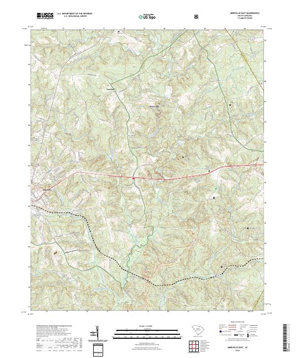
2024 Map of Abbeville East
USGS Topo · Published 2024About this map
The eastern surroundings of Abbeville are defined by a complex network of waterways and protected woodlands within the Sumter National Forest. This modern record of the South Carolina Piedmont shows the community expansion near the Abbeville Airport and the smaller settlements of Darraugh and Millers Mill. The topography is shaped by the winding course of Long Cane Creek and its many tributaries, including McCord Creek and Bagg Creek. Local historians can find numerous family and community burial sites scattered throughout the rural landscape, from the Ebenezer Church Graveyard to the isolated Tolbert Cemetery. The presence of several smaller graveyard labels like Aiken Cem and Big Adams Cem offers significant data for genealogical research, documenting the enduring footprint of long-established families across the undulating terrain between the Abbeville and Greenwood County line.
Find a feature on this map
109 named features on this map. Tap any name to fly to it.
Don’t see what you’re looking for? This feature index may not catch every label — zoom into the map to look around manually.
Map Details
Editions of this 2024 Abbeville East Map
This is the sole edition of this map. No revisions or reprints were ever made.
Other maps of this area

1892 · Abbeville
USGS Topo · 1:125,000

1948 · Abbeville East
USGS Topo · 1:24,000

1948 · Verdery
USGS Topo · 1:24,000

1948 · Abbeville West
USGS Topo · 1:24,000

1949 · Abbeville
USGS Topo · 1:24,000

1949 · Calhoun Creek
USGS Topo · 1:24,000

1949 · Greenwood
USGS Topo · 1:24,000

1950 · Bradley
USGS Topo · 1:24,000

1950 · Verdery
USGS Topo · 1:24,000

1950 · Abbeville East
USGS Topo · 1:24,000