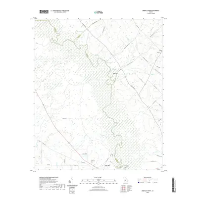
2020 Map of Abbeville North
USGS Topo · Published 2020About this map
The Ocmulgee River serves as the dominant geographic feature of this Georgia quadrangle, winding through the expansive wetlands of the Coastal Plain where the borders of Wilcox, Pulaski, and Dodge counties meet. In the south, the city of Abbeville sits perched above the riverbanks, an area defined by its relationship to the water and the surrounding agricultural landscape. The river corridor is marked by distinctive points such as Phelps Bluff and the natural outflow of Poor Robin Spring, while the broader terrain is dotted with significant local landmarks like Daniels Millpond and Burnham Bay. Genealogists and local historians can find several established burial sites documented here, including the Mitchell Family Cem, Cannonville Cem, and Bowen Cem near the settlement of Union. The road network, including the historic Old Abbeville Rd, connects these rural communities through a system of named routes such as Orphans Cemetery Rd and Free Gift Church Rd, reflecting the deep-rooted local heritage of the region.
Find a feature on this map
55 named features on this map. Tap any name to fly to it.
Don’t see what you’re looking for? This feature index may not catch every label — zoom into the map to look around manually.
Map Details
Editions of this 2020 Abbeville North Map
This is the sole edition of this map. No revisions or reprints were ever made.
Other maps of this area

1953 · Waycross
USGS Topo · 1:250,000

1957 · Macon
USGS Topo · 1:250,000

1958 · Macon
USGS Topo · 1:250,000

1958 · Waycross
USGS Topo · 1:250,000

1964 · Macon
USGS Topo · 1:250,000

1972 · Eastman
USGS Topo · 1:24,000

1972 · Finleyson East
USGS Topo · 1:24,000

1972 · West Of Eastman
USGS Topo · 1:24,000

1972 · Abbeville North
USGS Topo · 1:24,000

1972 · Pineview East
USGS Topo · 1:24,000