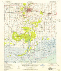
1954 Map of Abbeville
USGS Topo · Published 1956About this map
The Vermilion River carves through this mid-century landscape, serving as a vital artery for the region's agricultural and industrial life. Near the river's edge, the Live Oak Plantation stands as a significant landmark, while the Erath Oil and Gas Field to the east signals the era's growing energy economy. The mapping captures a network of small settlements and family-named cemeteries such as Bancker Cem and Delino Cem, reflecting deep-seated community roots.
Find a feature on this map
61 named features on this map. Tap any name to fly to it.
Don’t see what you’re looking for? This feature index may not catch every label — zoom into the map to look around manually.
Map Details
Editions of this 1954 Abbeville Map
3 editions found
Other maps of this area

1932 · Abbeville SW
USGS Topo · 1:31,680

1932 · Abbeville SE
USGS Topo · 1:31,680

1932 · Abbeville NE
USGS Topo · 1:31,680

1932 · Abbeville NW
USGS Topo · 1:31,680

1937 · Derouen
USGS Topo · 1:62,500

1939 · St. Martinsville
USGS Topo · 1:62,500

1945 · New Orleans
USGS Topo · 1:250,000

1945 · Pecan Island NE
USGS Topo · 1:31,680

1946 · Milton
USGS Topo · 1:31,680

1946 · Schooner Bayou SE
USGS Topo · 1:31,680