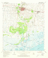
1954 Map of Abbeville
USGS Topo · Published 1973About this map
Abbeville serves as the focal point of this coastal Louisiana survey, where the Vermilion River snakes southward toward the marshlands and Vermilion Bay. The landscape is a complex network of natural bayous and man-made canals, reflecting an economy built on both water-based transport and the extraction industry. To the east, the Erath Oil and Gas Field and a nearby oil refinery mark the mid-century industrial footprint, while the Southern Pacific railroad connects settlements like Erath and Nunez.
Find a feature on this map
80 named features on this map. Tap any name to fly to it.
Don’t see what you’re looking for? This feature index may not catch every label — zoom into the map to look around manually.
Map Details
Editions of this 1954 Abbeville Map
3 editions found
Other maps of this area

1932 · Abbeville SW
USGS Topo · 1:31,680

1932 · Abbeville SE
USGS Topo · 1:31,680

1932 · Abbeville NE
USGS Topo · 1:31,680

1932 · Abbeville NW
USGS Topo · 1:31,680

1937 · Derouen
USGS Topo · 1:62,500

1939 · St. Martinsville
USGS Topo · 1:62,500

1945 · New Orleans
USGS Topo · 1:250,000

1945 · Pecan Island NE
USGS Topo · 1:31,680

1946 · Milton
USGS Topo · 1:31,680

1946 · Schooner Bayou SE
USGS Topo · 1:31,680