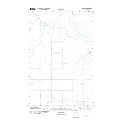
2011 Map of Abbott Lake
USGS Topo · Published 2011About this map
Cut Bank Creek and the Two Medicine River converge in this northern Montana landscape, marking the headwaters of the Marias River. The convergence occurs near the Sullivan Bridge, where the terrain transitions into a series of plateaus and drainages. The map details the local hydrology of the High Plains, including the namesake Abbott Lake and the nearby Stetler Lakes. Human presence is defined by established ranching operations like the Wilkins Ranch and the localized area of Willow Rounds. The irrigation infrastructure, essential for agricultural life in Glacier County, is represented by the An Canal and the Bullhead Drop along Bullhead Creek. Notable relief features such as Abbott Ridge and Abbott Coulee provide significant landmarks for understanding the natural drainage patterns that feed into the larger river systems of the region.
Find a feature on this map
22 named features on this map. Tap any name to fly to it.
Don’t see what you’re looking for? This feature index may not catch every label — zoom into the map to look around manually.
Map Details
Editions of this 2011 Abbott Lake Map
This is the sole edition of this map. No revisions or reprints were ever made.
Other maps of this area

1907 · Blackfoot Res.
USGS Topo · 1:48,000

1909 · Cut Bank
USGS Topo · 1:125,000

1912 · Cut Bank
USGS Topo · 1:125,000

1920 · Dupuyer
USGS Topo · 1:125,000

1934 · Lake Frances
USGS Topo · 1:48,000

1934 · Valier
USGS Topo · 1:62,500

1937 · Valier
USGS Topo · 1:62,500

1937 · Lake Frances
USGS Topo · 1:62,500

1960 · Cut Bank
USGS Topo · 1:250,000

1963 · Cut Bank
USGS Topo · 1:250,000