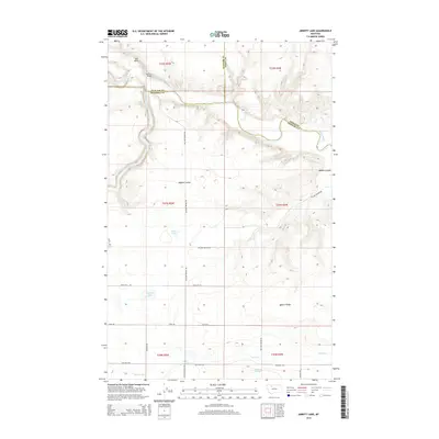
2014 Map of Abbott Lake
USGS Topo · Published 2014About this map
Cut Bank Creek and the Two Medicine River converge at the northern edge of this Montana landscape to form the Marias River, a critical hydrological junction that has historically defined local boundaries. The terrain is characterized by deep coulees and significant elevation changes, notably across Abbott Ridge and the winding Abbott Coulee. This 2014 survey documents the complex water management infrastructure supporting the region's agricultural interests, including the An Canal, An Six Canal, and the Bullhead Drop. Scattered water bodies like Abbott Lake and Stetler Lakes dot the interior, while a network of rural roads such as Sullivan Bridge Rd and Willow Rounds Rd provide access to the high plains. The map also records the Sullivan Bridge, a localized landmark crossing the northern waterways near the tri-county intersection of Glacier, Toole, and Pondera.
Find a feature on this map
32 named features on this map. Tap any name to fly to it.
Don’t see what you’re looking for? This feature index may not catch every label — zoom into the map to look around manually.
Map Details
Editions of this 2014 Abbott Lake Map
This is the sole edition of this map. No revisions or reprints were ever made.
Other maps of this area

1907 · Blackfoot Res.
USGS Topo · 1:48,000

1909 · Cut Bank
USGS Topo · 1:125,000

1912 · Cut Bank
USGS Topo · 1:125,000

1920 · Dupuyer
USGS Topo · 1:125,000

1934 · Lake Frances
USGS Topo · 1:48,000

1934 · Valier
USGS Topo · 1:62,500

1937 · Valier
USGS Topo · 1:62,500

1937 · Lake Frances
USGS Topo · 1:62,500

1960 · Cut Bank
USGS Topo · 1:250,000

1963 · Cut Bank
USGS Topo · 1:250,000