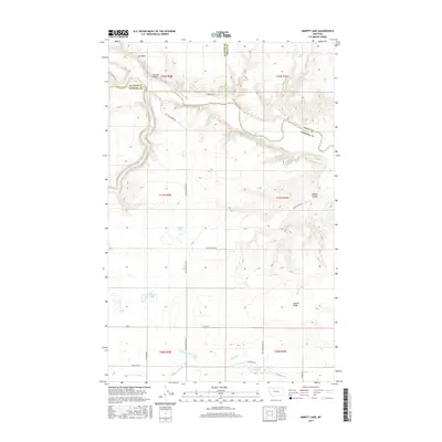
2017 Map of Abbott Lake
USGS Topo · Published 2017About this map
The Marias River forms a central geographical anchor on this map, meeting the Two Medicine River and Cut Bank Creek in a complex drainage network at the triple-border intersection of Glacier, Toole, and Pondera Counties. This northern Montana landscape is defined by the high plains topography of the Cut Bank and Abbott Ridge, where the winding river valleys cut deep through the terrain. Evidence of the region’s vital irrigation infrastructure is visible in the south, where the AN Canal and AN Six Canal traverse the land alongside Bullhead Springs and the Bullhead Drop. Small, scattered water bodies like Abbott Lake and Stetler Lakes dot the landscape between notable landforms like Abbott Coulee and the wide flats of Willow Rounds. A network of rural roads, including Sullivan Bridge Rd and Mallard Springs Rd, provides access across these open reaches and to the historic crossing at Sullivan Bridge.
Find a feature on this map
31 named features on this map. Tap any name to fly to it.
Don’t see what you’re looking for? This feature index may not catch every label — zoom into the map to look around manually.
Map Details
Editions of this 2017 Abbott Lake Map
This is the sole edition of this map. No revisions or reprints were ever made.
Other maps of this area

1907 · Blackfoot Res.
USGS Topo · 1:48,000

1909 · Cut Bank
USGS Topo · 1:125,000

1912 · Cut Bank
USGS Topo · 1:125,000

1920 · Dupuyer
USGS Topo · 1:125,000

1934 · Lake Frances
USGS Topo · 1:48,000

1934 · Valier
USGS Topo · 1:62,500

1937 · Valier
USGS Topo · 1:62,500

1937 · Lake Frances
USGS Topo · 1:62,500

1960 · Cut Bank
USGS Topo · 1:250,000

1963 · Cut Bank
USGS Topo · 1:250,000