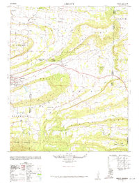
1948 Map of Abbott
USGS Topo · Published 1971About this map
The rugged topography of the Ouachita Mountains foothills defines this 1948 survey, where the Sebastian County Scott County line divides several small communities and ridges. Local life at mid-century centers around Abbott and Mansfield, with the latter featuring Mansfield Lake and a namesake Cemetery. Education and faith are well-represented by rural landmarks like the Crossroads School and Pleasant Grove Church.
Find a feature on this map
42 named features on this map. Tap any name to fly to it.
Don’t see what you’re looking for? This feature index may not catch every label — zoom into the map to look around manually.
Map Details
Editions of this 1948 Abbott Map
4 editions found
Other maps of this area

1879 · Poteau Mountain
USGS Topo · 1:62,500

1887 · Poteau Mountain #1
USGS Topo · 1:62,500

1887 · Poteau Mountain #2
USGS Topo · 1:62,500

1887 · Greenwood
USGS Topo · 1:62,500

1890 · Fort Smith
USGS Topo · 1:125,000

1890 · Poteau Mountain
USGS Topo · 1:125,000

1899 · Poteau Mountain
USGS Topo · 1:125,000

1906 · Barber
USGS Topo · 1:62,500

1939 · Waldron
USGS Topo · 1:62,500

1940 · Waldron
USGS Topo · 1:62,500