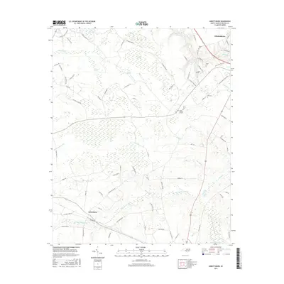
2016 Map of Abbottsburg
USGS Topo · Published 2016About this map
Brown Marsh Swamp and Singletary Swamp dominate the low-lying landscape of Bladen County, defining the drainage patterns south of Elizabethtown. This 2016 survey highlights a terrain transition where agricultural tracts and timberlands are carved out of extensive wetland complexes like Woolie Swamp and Cypress Swamp. The community of Abbottsburg serves as a local anchor in the southwest, while the northern section of the map shows the edge of the county seat. Numerous small family or community cemeteries are scattered throughout the region, including Benson Cem, McGill Cem, and Rising Cem, providing critical geographic markers for genealogists. The water network is intricate, featuring man-made engineering such as the Bryant Swamp Canal and Marsh Canal alongside natural features like Big Juniper Bay and Grays Bay, illustrating the long-standing efforts to manage the water levels of this coastal plain environment.
Find a feature on this map
83 named features on this map. Tap any name to fly to it.
Don’t see what you’re looking for? This feature index may not catch every label — zoom into the map to look around manually.
Map Details
Editions of this 2016 Abbottsburg Map
This is the sole edition of this map. No revisions or reprints were ever made.
Other maps of this area

1953 · Chadbourn
USGS Topo · 1:62,500

1953 · Florence
USGS Topo · 1:250,000

1954 · Florence
USGS Topo · 1:250,000

1955 · Whiteville
USGS Topo · 1:62,500

1955 · Elizabethtown
USGS Topo · 1:62,500

1957 · Bladenboro
USGS Topo · 1:62,500

1982 · Elizabethtown
USGS Topo · 1:100,000

1986 · Whiteville
USGS Topo · 1:100,000

1986 · Tar Heel
USGS Topo · 1:24,000
1986 · Bladenboro
USGS Topo · 1:24,000