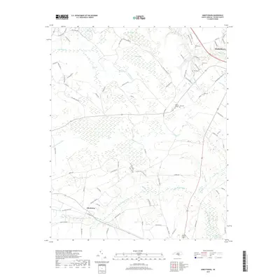
2019 Map of Abbottsburg
USGS Topo · Published 2019About this map
Brown Marsh Swamp and an intricate network of waterways dominate this portion of Bladen County, where the landscape transitions between low-lying wetlands and established agricultural tracts. The settlement of Abbottsburg serves as a local anchor in the southwest, while the outskirts of Elizabethtown appear in the northeast near Browns Cr. The presence of several family and community burial sites, including Benson Cem, McGill Cem, and Pone Cem, provides significant points of interest for genealogical research in this rural coastal plain region.
Find a feature on this map
85 named features on this map. Tap any name to fly to it.
Don’t see what you’re looking for? This feature index may not catch every label — zoom into the map to look around manually.
Map Details
Editions of this 2019 Abbottsburg Map
This is the sole edition of this map. No revisions or reprints were ever made.
Other maps of this area

1953 · Chadbourn
USGS Topo · 1:62,500

1953 · Florence
USGS Topo · 1:250,000

1954 · Florence
USGS Topo · 1:250,000

1955 · Whiteville
USGS Topo · 1:62,500

1955 · Elizabethtown
USGS Topo · 1:62,500

1957 · Bladenboro
USGS Topo · 1:62,500

1982 · Elizabethtown
USGS Topo · 1:100,000

1986 · Whiteville
USGS Topo · 1:100,000

1986 · Tar Heel
USGS Topo · 1:24,000
1986 · Bladenboro
USGS Topo · 1:24,000