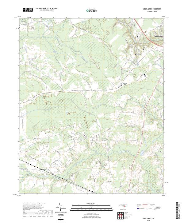
2022 Map of Abbottsburg
USGS Topo · Published 2022About this map
Brown Marsh Swamp and Marsh Canal define the low-lying, water-braided landscape of this Bladen County region. The settlement of Abbottsburg serves as a focal point in the southwestern corner, while the outskirts of Elizabethtown appear to the northeast. This 2022 survey captures a distinct coastal plain environment where agriculture and rural residences are hemmed in by significant wetland systems like Singletary Swamp, Woolie Swamp, and Cypress Swamp. Numerous named bays, such as Big Juniper Bay and Rake Shin Bay, dot the terrain, illustrating the unique Carolina Bay geological features of the area. A network of country roads, including Old Wesley Chapel Rd and Twisted Hickory Rd, connects the scattered farmsteads and homesites. To the north, Paris Millpond suggests historical water management, while Bladen Memorial Gardens provides a significant local landmark near the center of the quadrangle.
Find a feature on this map
81 named features on this map. Tap any name to fly to it.
Don’t see what you’re looking for? This feature index may not catch every label — zoom into the map to look around manually.
Map Details
Editions of this 2022 Abbottsburg Map
This is the sole edition of this map. No revisions or reprints were ever made.
Other maps of this area

1953 · Chadbourn
USGS Topo · 1:62,500

1953 · Florence
USGS Topo · 1:250,000

1954 · Florence
USGS Topo · 1:250,000

1955 · Whiteville
USGS Topo · 1:62,500

1955 · Elizabethtown
USGS Topo · 1:62,500

1957 · Bladenboro
USGS Topo · 1:62,500

1982 · Elizabethtown
USGS Topo · 1:100,000

1986 · Whiteville
USGS Topo · 1:100,000

1986 · Tar Heel
USGS Topo · 1:24,000
1986 · Bladenboro
USGS Topo · 1:24,000