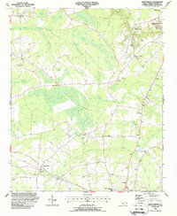
1987 Map of Abbottsburg
USGS Topo · Published 1987About this map
Abbottsburg and the southern reaches of Elizabethtown anchor this Bladen County landscape, where the CSX railroad cuts through a terrain defined by extensive swamp networks and distinct Carolina bays. These elliptical depressions, such as Big Juniper Bay and Shin Rake Bay, dictate the local drainage patterns and provide a unique backdrop for the area's agricultural and timber operations. The map reveals a deeply rooted rural community, evidenced by the high density of country churches and family burial grounds scattered throughout the wetlands.
Find a feature on this map
49 named features on this map. Tap any name to fly to it.
Don’t see what you’re looking for? This feature index may not catch every label — zoom into the map to look around manually.
Map Details
Editions of this 1987 Abbottsburg Map
This is the sole edition of this map. No revisions or reprints were ever made.
Other maps of this area

1953 · Chadbourn
USGS Topo · 1:62,500

1953 · Florence
USGS Topo · 1:250,000

1954 · Florence
USGS Topo · 1:250,000

1955 · Whiteville
USGS Topo · 1:62,500

1955 · Elizabethtown
USGS Topo · 1:62,500

1957 · Bladenboro
USGS Topo · 1:62,500

1982 · Elizabethtown
USGS Topo · 1:100,000

1986 · Whiteville
USGS Topo · 1:100,000

1986 · Tar Heel
USGS Topo · 1:24,000
1986 · Bladenboro
USGS Topo · 1:24,000