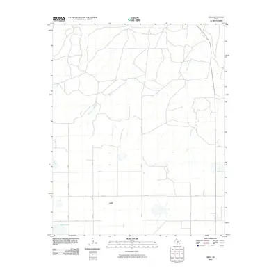
2010 Map of Abell
USGS Topo · Published 2010About this map
Abell serves as the focal point of this High Plains landscape, situated amidst a grid of rural roads and drainage systems in Carson County. The terrain is defined by the headwaters of West Dixon Creek and Middle Dixon Creek, which carve subtle paths across the prairie. The presence of Pantex Lake in the southwestern corner indicates the importance of surface water in this agricultural region. Transportation in the area relies on a network of Farm-to-Market and County Roads, such as FM 1342 and Co RD K, which facilitate movement between the scattered farmsteads and larger regional centers. This map provides a look at the land use and topographic character of the Texas Panhandle at the beginning of the 21st century, illustrating how the natural drainage of the Dixon Creek system interacts with human infrastructure.
Find a feature on this map
14 named features on this map. Tap any name to fly to it.
Don’t see what you’re looking for? This feature index may not catch every label — zoom into the map to look around manually.
Map Details
Editions of this 2010 Abell Map
This is the sole edition of this map. No revisions or reprints were ever made.
Other maps of this area

1939 · Sanford
USGS Topo · 1:62,500

1953 · Deal
USGS Topo · 1:24,000

1953 · Borger SE
USGS Topo · 1:24,000

1953 · Pomeroy
USGS Topo · 1:24,000

1953 · McBride
USGS Topo · 1:24,000

1953 · Sevenmile Basin
USGS Topo · 1:24,000

1954 · Amarillo
USGS Topo · 1:250,000

1958 · Amarillo
USGS Topo · 1:250,000

1965 · Abell
USGS Topo · 1:24,000

1966 · Panhandle West
USGS Topo · 1:24,000