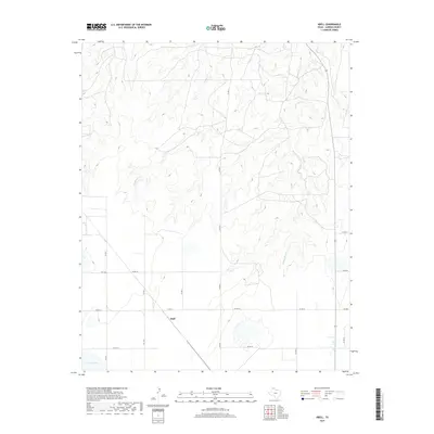
2019 Map of Abell
USGS Topo · Published 2019About this map
Abell sits at a crossroads of ranch roads and farm-to-market routes in this survey of the Texas Panhandle landscape. The terrain is defined by the drainage systems of W Dixon Cr and Middle Dixon Cr, which carve subtle relief into the High Plains. To the southwest, Pantex Lake provides a notable hydrologic feature in an otherwise arid, pastoral environment. The map details the local transportation grid, including FM 1342 and FM 2385, illustrating the sparse but organized settlement pattern of Carson County. These roads serve as the primary lifelines between isolated agricultural properties and the small community center at Abell, reflecting the enduring rural character of the region in the early twenty-first century.
Find a feature on this map
14 named features on this map. Tap any name to fly to it.
Don’t see what you’re looking for? This feature index may not catch every label — zoom into the map to look around manually.
Map Details
Editions of this 2019 Abell Map
This is the sole edition of this map. No revisions or reprints were ever made.
Other maps of this area

1939 · Sanford
USGS Topo · 1:62,500

1953 · Deal
USGS Topo · 1:24,000

1953 · Borger SE
USGS Topo · 1:24,000

1953 · Pomeroy
USGS Topo · 1:24,000

1953 · McBride
USGS Topo · 1:24,000

1953 · Sevenmile Basin
USGS Topo · 1:24,000

1954 · Amarillo
USGS Topo · 1:250,000

1958 · Amarillo
USGS Topo · 1:250,000

1965 · Abell
USGS Topo · 1:24,000

1966 · Panhandle West
USGS Topo · 1:24,000