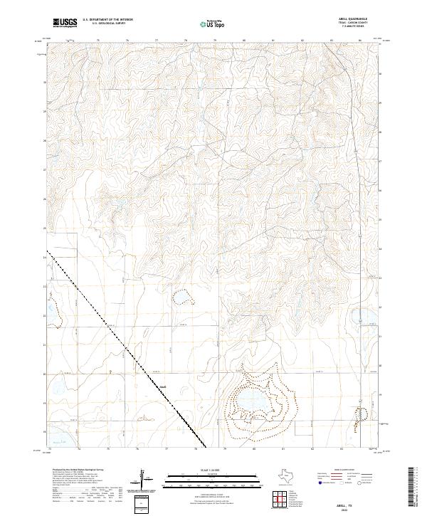
2022 Map of Abell
USGS Topo · Published 2022About this map
The settlement of Abell anchors this portion of the Texas Panhandle, situated where the high plains begin to break into the drainage systems of the Canadian River watershed. To the north, the terrain is defined by the headwaters and winding paths of W Dixon Cr and Middle Dixon Cr, which carve distinct draws through the landscape. These ephemeral watercourses contrast with the southern reaches of the map, where the flat upland contains isolated features like Pantex Lake.
Find a feature on this map
15 named features on this map. Tap any name to fly to it.
Don’t see what you’re looking for? This feature index may not catch every label — zoom into the map to look around manually.
Map Details
Editions of this 2022 Abell Map
This is the sole edition of this map. No revisions or reprints were ever made.
Other maps of this area

1939 · Sanford
USGS Topo · 1:62,500

1953 · Deal
USGS Topo · 1:24,000

1953 · Borger SE
USGS Topo · 1:24,000

1953 · Pomeroy
USGS Topo · 1:24,000

1953 · McBride
USGS Topo · 1:24,000

1953 · Sevenmile Basin
USGS Topo · 1:24,000

1954 · Amarillo
USGS Topo · 1:250,000

1958 · Amarillo
USGS Topo · 1:250,000

1965 · Abell
USGS Topo · 1:24,000

1966 · Panhandle West
USGS Topo · 1:24,000