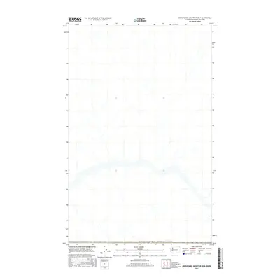
2017 Map of Abercrombie Mountain OE N
USGS Topo · Published 2017About this map
The international border between the United States of America and Canada serves as the primary focal point for this survey. Published by the U.S. Geological Survey in 2017, the map delineates a remote stretch of the 49th parallel where the Washington-British Columbia boundary crosses a complex network of unnamed northern drainages. While many historical topographic maps are dense with named summits and settlements, this particular sheet focuses on the precision of the international line itself, as established by multiple agencies including the Bureau of Land Management and the U.S. Census Bureau. This document is a critical reference for understanding how modern cartographic standards like the North American Datum of 1983 are applied to the stark geographic reality of the borderlands north of Abercrombie Mountain.
Find a feature on this map
1 named feature on this map. Tap any name to fly to it.
Don’t see what you’re looking for? This feature index may not catch every label — zoom into the map to look around manually.
Map Details
Editions of this 2017 Abercrombie Mountain OE N Map
This is the sole edition of this map. No revisions or reprints were ever made.
Other maps of this area

1929 · Colville
USGS Topo · 1:125,000

1933 · Colville
USGS Topo · 1:125,000

1934 · Metaline
USGS Topo · 1:125,000

1942 · Metaline
USGS Topo · 1:125,000

1952 · Leadpoint
USGS Topo · 1:24,000

1958 · Sandpoint
USGS Topo · 1:250,000

1963 · Sandpoint
USGS Topo · 1:250,000

1967 · Boundary Dam
USGS Topo · 1:24,000
1967 · Abercrombie Mtn
USGS Topo · 1:24,000
1984 · Colville
USGS Topo · 1:100,000