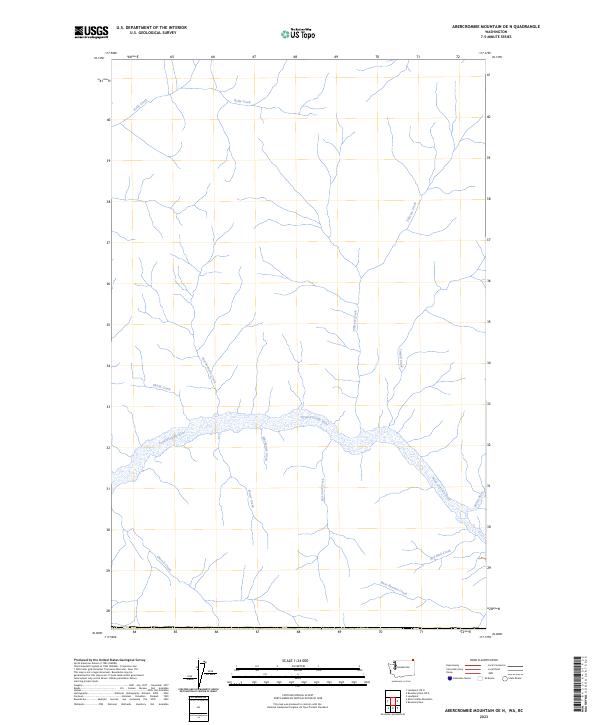
2023 Map of Abercrombie Mountain OE N
USGS Topo · Published 2023About this map
The Pend Oreille River cuts through this northern Washington landscape, serving as the central drainage for a dense network of mountain tributaries near the Canadian border. The river's path is fed by numerous named creeks including Mackenzie Creek, Fraser Creek, and Harcourt Creek, which flow from the south, while Tillicum Creek and Limpid Creek descend from the north. This 2023 survey illustrates a wilderness-oriented terrain where water is the primary named feature, showing the confluence where the Salmo River enters the Pend Oreille system.
Find a feature on this map
13 named features on this map. Tap any name to fly to it.
Don’t see what you’re looking for? This feature index may not catch every label — zoom into the map to look around manually.
Map Details
Editions of this 2023 Abercrombie Mountain OE N Map
This is the sole edition of this map. No revisions or reprints were ever made.
Other maps of this area

1929 · Colville
USGS Topo · 1:125,000

1933 · Colville
USGS Topo · 1:125,000

1934 · Metaline
USGS Topo · 1:125,000

1942 · Metaline
USGS Topo · 1:125,000

1952 · Leadpoint
USGS Topo · 1:24,000

1958 · Sandpoint
USGS Topo · 1:250,000

1963 · Sandpoint
USGS Topo · 1:250,000

1967 · Boundary Dam
USGS Topo · 1:24,000
1967 · Abercrombie Mtn
USGS Topo · 1:24,000
1984 · Colville
USGS Topo · 1:100,000