
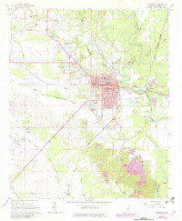
1966 Map of Aberdeen
USGS Topo · Published 1967About this map
Aberdeen serves as a significant regional hub along the Tombigbee River, where the convergence of the Illinois Central Railroad and the St Louis - San Francisco Railroad historically drove the local economy. The town's civic importance is anchored by the Courthouse and several educational landmarks, including Shivers High Sch and a central High Sch. Beyond the dense grid of the county seat, the landscape is defined by the winding paths of Mattubby Creek and James Creek, which carve through the surrounding bottomlands.
Find a feature on this map
49 named features on this map. Tap any name to fly to it.
Don’t see what you’re looking for? This feature index may not catch every label — zoom into the map to look around manually.
Map Details
Editions of this 1966 Aberdeen Map
2 editions found
Other maps of this area

1953 · West Point
USGS Topo · 1:250,000

1958 · West Point
USGS Topo · 1:250,000

1959 · West Point
USGS Topo · 1:62,500

1960 · Caledonia
USGS Topo · 1:62,500

1963 · West Point
USGS Topo · 1:250,000

1965 · Egypt
USGS Topo · 1:24,000

1966 · Amory
USGS Topo · 1:24,000

1966 · Amory SW
USGS Topo · 1:24,000

1966 · Wren
USGS Topo · 1:24,000

1966 · Prairie
USGS Topo · 1:24,000