
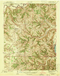
1943 Map of Aberdeen
USGS Topo · Published 1943About this map
The Ohio River defines the southeastern border of this 1940s landscape, where small agricultural hubs and family homesteads are connected by a dense network of country roads. Small settlements like Aberdeen and Hartford serve as anchors for a community defined by its topography, with ridges and valleys carved by Laughery Creek, Arnold Creek, and Grants Creek. This era of rural Indiana is characterized by localized infrastructure, evidenced by the high density of one-room schoolhouses and parish churches that served scattered farming families across Washington, Buckeye, and Cass townships.
Find a feature on this map
45 named features on this map. Tap any name to fly to it.
Don’t see what you’re looking for? This feature index may not catch every label — zoom into the map to look around manually.
Map Details
Editions of this 1943 Aberdeen Map
2 editions found
Other maps of this area

1915 · Lawrenceburg
USGS Topo · 1:48,000

1928 · Lawrenceburg
USGS Topo · 1:62,500

1932 · Lawrenceburg
USGS Topo · 1:62,500

1943 · Florence
USGS Topo · 1:24,000

1943 · Aurora
USGS Topo · 1:24,000

1943 · Vevay North
USGS Topo · 1:24,000

1943 · Rising Sun
USGS Topo · 1:24,000

1943 · Lawrenceburg
USGS Topo · 1:24,000

1943 · Patriot
USGS Topo · 1:24,000

1951 · Florence
USGS Topo · 1:24,000