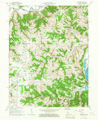
1965 Map of Aberdeen
USGS Topo · Published 1967About this map
Laughery Creek and the Ohio River define the northern and eastern reaches of this topographic study, where the borders of Dearborn, Ohio, and Switzerland counties converge. The interior is a dissected landscape of ridges including Poorhouse Hill and Stewart Ridge, which shaped the placement of rural roads and small 1960s farming communities.
Find a feature on this map
69 named features on this map. Tap any name to fly to it.
Don’t see what you’re looking for? This feature index may not catch every label — zoom into the map to look around manually.
Map Details
Editions of this 1965 Aberdeen Map
3 editions found
Other maps of this area

1915 · Lawrenceburg
USGS Topo · 1:48,000

1928 · Lawrenceburg
USGS Topo · 1:62,500

1932 · Lawrenceburg
USGS Topo · 1:62,500

1943 · Florence
USGS Topo · 1:24,000

1943 · Aberdeen
USGS Topo · 1:24,000

1943 · Aurora
USGS Topo · 1:24,000

1943 · Vevay North
USGS Topo · 1:24,000

1943 · Rising Sun
USGS Topo · 1:24,000

1943 · Lawrenceburg
USGS Topo · 1:24,000

1943 · Patriot
USGS Topo · 1:24,000