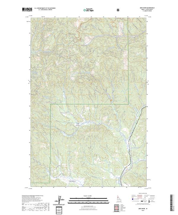
2024 Map of Abes Knob
USGS Topo · Published 2024About this map
The Hoodoo Mountains define the northern reaches of this Idaho landscape, dominated by the heavily forested slopes of the St Joe National Forest. The geography is centered on Abes Knob and nearby Beals Butte, serving as a high-altitude drainage basin for several significant waterways. The headwaters of the Palouse River and the West Fork Potlatch River carve deep valleys through the timberland, while high-elevation clearings like Cougar Meadows and Moose Meadows provide rare level ground in the terrain. The presence of the Palouse Divide indicates a major local watershed boundary, influencing the complex network of creeks such as Emerald Creek and Johnson Creek. This modern survey reveals a landscape primarily dedicated to conservation and forestry, with a dense grid of service routes including Emerald Creek Rd and Nat For Dev Rd 1954 facilitating access to these remote ridgelines and gulches.
Find a feature on this map
48 named features on this map. Tap any name to fly to it.
Don’t see what you’re looking for? This feature index may not catch every label — zoom into the map to look around manually.
Map Details
Editions of this 2024 Abes Knob Map
This is the sole edition of this map. No revisions or reprints were ever made.
Other maps of this area

1955 · Pullman
USGS Topo · 1:250,000

1955 · Spokane
USGS Topo · 1:250,000

1957 · Emida
USGS Topo · 1:62,500

1958 · Spokane
USGS Topo · 1:250,000

1958 · Pullman
USGS Topo · 1:250,000

1961 · Deary
USGS Topo · 1:62,500

1961 · Fernwood
USGS Topo · 1:62,500

1961 · Bovill
USGS Topo · 1:62,500

1981 · St Maries
USGS Topo · 1:100,000

1981 · Potlatch
USGS Topo · 1:100,000