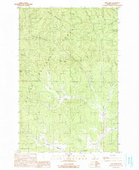
1990 Map of Abes Knob
USGS Topo · Published 1991About this map
St Joe National Forest dominates this northern Idaho landscape at the start of the 1990s, defined by the drainage systems of the Potlatch River and the Palouse River. The map captures a high-elevation backcountry where the Hoodoo Mountains meet the Boise Meridian. Resource extraction and recreation converge at the Mizpah Mine near Mizpah Creek and the Moose Creek Reservoir to the south. The topography is intricately detailed, showing the transition from peaks like Abes Knob and Beals Butte down to the broad, flat expanses of Cougar Meadows and Moose Meadows. The network of small waterways, such as East Fork Emerald Creek and Little East Fk Emerald Cr, illustrates the complex hydrology of this timber-rich region, while a dedicated Pack Trail suggests the limited access to the interior of these forest lands.
Find a feature on this map
38 named features on this map. Tap any name to fly to it.
Don’t see what you’re looking for? This feature index may not catch every label — zoom into the map to look around manually.
Map Details
Editions of this 1990 Abes Knob Map
This is the sole edition of this map. No revisions or reprints were ever made.
Other maps of this area

1955 · Pullman
USGS Topo · 1:250,000

1955 · Spokane
USGS Topo · 1:250,000

1957 · Emida
USGS Topo · 1:62,500

1958 · Spokane
USGS Topo · 1:250,000

1958 · Pullman
USGS Topo · 1:250,000

1961 · Deary
USGS Topo · 1:62,500

1961 · Fernwood
USGS Topo · 1:62,500

1961 · Bovill
USGS Topo · 1:62,500

1981 · St Maries
USGS Topo · 1:100,000

1981 · Potlatch
USGS Topo · 1:100,000