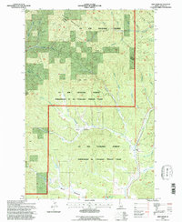
1994 Map of Abes Knob
USGS Topo · Published 1997About this map
Hoodoo Mountains terrain and the headwaters of the Potlatch River define this corner of northern Idaho, where industrial land use meets protected forest. The presence of the Mizpah Mine and the Emerald Creek Garnet Area highlights the region's mineral history, while the Gravel Pit indicates more modern infrastructure development. This area of the St Joe National Forest is unique for being administered by the neighboring Clearwater National Forest, creating a complex management landscape.
Find a feature on this map
41 named features on this map. Tap any name to fly to it.
Don’t see what you’re looking for? This feature index may not catch every label — zoom into the map to look around manually.
Map Details
Editions of this 1994 Abes Knob Map
This is the sole edition of this map. No revisions or reprints were ever made.
Other maps of this area

1955 · Pullman
USGS Topo · 1:250,000

1955 · Spokane
USGS Topo · 1:250,000

1957 · Emida
USGS Topo · 1:62,500

1958 · Spokane
USGS Topo · 1:250,000

1958 · Pullman
USGS Topo · 1:250,000

1961 · Deary
USGS Topo · 1:62,500

1961 · Fernwood
USGS Topo · 1:62,500

1961 · Bovill
USGS Topo · 1:62,500

1981 · St Maries
USGS Topo · 1:100,000

1981 · Potlatch
USGS Topo · 1:100,000