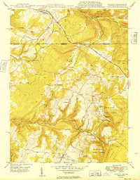
1949 Map of Accident
USGS Topo · Published 1949About this map
Accident and the surrounding Maryland-Pennsylvania borderlands appear here in the post-war era, characterized by a mix of agricultural valley settlements and dense timberlands. The National Pike serves as the primary artery through the northern section of the map, crossing from Pennsylvania into Maryland at Strawn. The landscape is dotted with early industry and community landmarks, including the Sausman Mine and water-powered sites such as Kaese Mill and Engle Mill along the banks of Bear Creek.
Find a feature on this map
43 named features on this map. Tap any name to fly to it.
Don’t see what you’re looking for? This feature index may not catch every label — zoom into the map to look around manually.
Map Details
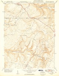
Editions of this 1949 Accident Map
2 editions found
Other maps of this area

1899 · Grantsville
USGS Topo · 1:62,500

1900 · Accident
USGS Topo · 1:62,500

1904 · Grantsville
USGS Topo · 1:62,500

1921 · Meyersdale
USGS Topo · 1:62,500

1922 · Confluence
USGS Topo · 1:62,500

1931 · Confluence
USGS Topo · 1:62,500

1933 · Confluence
USGS Topo · 1:62,500

1939 · Meyersdale
USGS Topo · 1:62,500

1944 · Meyersdale
USGS Topo · 1:62,500

1946 · Grantsville
USGS Topo · 1:24,000