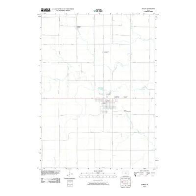
2010 Map of Ackley
USGS Topo · Published 2010About this map
Ackley sits at the intersection of a vast agricultural grid, serving as a hub for the surrounding rural landscape in North Central Iowa. The town's layout is meticulously detailed, highlighting local landmarks like the Ackley Post Office and the nearby Ackley Municipal Airport. This 2010 survey reflects a settled landscape where three distinct burial grounds—Pleasant Hill Cemetery, Oak Wood Cemetery, and Saint Marys Cemetery—mark the community's long-standing roots.
Find a feature on this map
44 named features on this map. Tap any name to fly to it.
Don’t see what you’re looking for? This feature index may not catch every label — zoom into the map to look around manually.
Map Details
Editions of this 2010 Ackley Map
This is the sole edition of this map. No revisions or reprints were ever made.
Other maps of this area

1954 · Waterloo
USGS Topo · 1:250,000

1955 · Waterloo
USGS Topo · 1:250,000

1979 · Ackley NE
USGS Topo · 1:24,000

1979 · Ackley
USGS Topo · 1:24,000

1979 · Steamboat Rock
USGS Topo · 1:24,000

1979 · Iowa Falls East
USGS Topo · 1:24,000
1979 · Hampton South
USGS Topo · 1:24,000

1979 · Dumont South
USGS Topo · 1:24,000
1979 · Owasa
USGS Topo · 1:24,000

1980 · Aplington
USGS Topo · 1:24,000