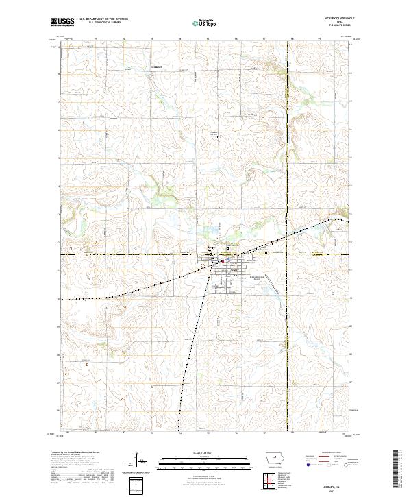
2022 Map of Ackley
USGS Topo · Published 2022About this map
The settlement of Ackley serves as the focal point for this landscape, uniquely situated at the junction where Franklin, Butler, Hardin, and Grundy counties meet. The town's grid is dense with street names like Main St and Park Ave, and its eastern edge is bordered by the Ackley Municipal Airport. North of town, the small community of Faulkner sits near N Beaver Cr, marking a region defined by agricultural plots and a complex network of township and range lines.
Find a feature on this map
74 named features on this map. Tap any name to fly to it.
Don’t see what you’re looking for? This feature index may not catch every label — zoom into the map to look around manually.
Map Details
Editions of this 2022 Ackley Map
This is the sole edition of this map. No revisions or reprints were ever made.
Other maps of this area

1954 · Waterloo
USGS Topo · 1:250,000

1955 · Waterloo
USGS Topo · 1:250,000

1979 · Ackley NE
USGS Topo · 1:24,000

1979 · Ackley
USGS Topo · 1:24,000

1979 · Steamboat Rock
USGS Topo · 1:24,000

1979 · Iowa Falls East
USGS Topo · 1:24,000
1979 · Hampton South
USGS Topo · 1:24,000

1979 · Dumont South
USGS Topo · 1:24,000
1979 · Owasa
USGS Topo · 1:24,000

1980 · Aplington
USGS Topo · 1:24,000