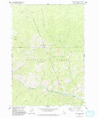
1973 Map of Acorn Butte
USGS Topo · Published 1993About this map
Big Creek winds through the heart of this central Idaho landscape, which was surveyed in the early 1970s within the Frank Church-River of No Return Wilderness and Payette National Forest. This remote backcountry is characterized by steep drainage systems and high ridges like Snowshoe Ridge and Lookout Mountain. Along the river corridor, distinctive river bars with whimsical names such as Hard Boil Bar, Over Easy Bar, and Soft Boil Bar indicate the specialized terminology of wilderness travelers and river runners of the era. Evidence of early 20th-century resource extraction and habitation remains at the Snowshoe Mine and the Jensen Cabin site near Bismark Creek. A small Landing Strip near Mile Flat provides a rare point of access into this roadless interior, where historical travel relied on an extensive network including the Bismark Trail and the Pack Trail that crosses the Idaho County and Valley County line.
Find a feature on this map
42 named features on this map. Tap any name to fly to it.
Don’t see what you’re looking for? This feature index may not catch every label — zoom into the map to look around manually.
Map Details
Editions of this 1973 Acorn Butte Map
2 editions found
Other maps of this area

1956 · Elk City
USGS Topo · 1:250,000

1960 · Elk City
USGS Topo · 1:250,000

1962 · Mormon Mtn
USGS Topo · 1:24,000

1962 · Vinegar Hill
USGS Topo · 1:24,000

1973 · Center Mtn
USGS Topo · 1:24,000

1973 · Acorn Butte
USGS Topo · 1:24,000

1973 · Bismark Mtn
USGS Topo · 1:24,000
1973 · Monument
USGS Topo · 1:24,000

1978 · Wapiti Creek
USGS Topo · 1:24,000
1978 · Lodgepole Creek
USGS Topo · 1:24,000