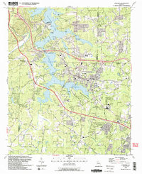
1992 Map of Acworth
USGS Topo · Published 1993About this map
Acworth sits at the nexus of several North Georgia counties on this 1992 survey, positioned where the waters of Allatoona Lake and Lake Acworth meet. The map reveals a landscape defined by significant infrastructure and growing suburban density, with the CSX Transportation rail line and Cobb Parkway serving as primary transit corridors. Educational and religious institutions are particularly dense here, including North Cobb High School and Awtrey Middle School, alongside older local landmarks like Liberty Hill Cemetery and Mars Hill Cemetery.
Find a feature on this map
62 named features on this map. Tap any name to fly to it.
Don’t see what you’re looking for? This feature index may not catch every label — zoom into the map to look around manually.
Map Details
Editions of this 1992 Acworth Map
2 editions found
Other maps of this area

1890 · Cartersville
USGS Topo · 1:125,000

1891 · Marietta
USGS Topo · 1:125,000

1891 · Cartersville
USGS Topo · 1:125,000

1895 · Marietta
USGS Topo · 1:125,000

1896 · Cartersville
USGS Topo · 1:125,000

1897 · Marietta
USGS Topo · 1:125,000

1901 · Marietta
USGS Topo · 1:125,000

1906 · Stilesboro
USGS Topo · 1:62,500

1907 · Acworth
USGS Topo · 1:62,500

1908 · Stilesboro
USGS Topo · 1:62,500