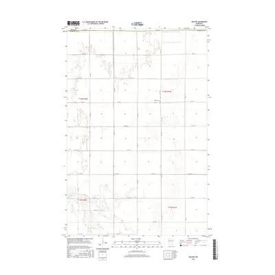
2016 Map of Ada NW
USGS Topo · Published 2016About this map
The Marsh River meanders across the southern landscape of this Polk and Norman County borderland, illustrating the complex hydrology of the Red River Valley. In a region where natural drainage is often supplemented by engineering, the presence of Judicial Ditch Number Fiftytwo and Judicial Ditch Number Fiftythree reveals the extensive history of land reclamation and agricultural development. The geometric grid of rural routes, including Co Rd 3 and Co Rd 121, defines the township and range system, providing access to the fertile prairies. Bethany Cem stands as a focal point for local genealogy, marking the center of this rural community. The map preserves the late twentieth-century landscape of these townships, from the winding riverbed to the precisely plotted drainage canals and county roads like Co Rd 145.
Find a feature on this map
26 named features on this map. Tap any name to fly to it.
Don’t see what you’re looking for? This feature index may not catch every label — zoom into the map to look around manually.
Map Details
Editions of this 2016 Ada NW Map
This is the sole edition of this map. No revisions or reprints were ever made.
Other maps of this area

1918 · Hendrum
USGS Topo · 1:62,500

1919 · Eldred
USGS Topo · 1:62,500

1919 · Beltrami
USGS Topo · 1:62,500

1924 · Ada
USGS Topo · 1:62,500

1952 · Grand Forks
USGS Topo · 1:250,000

1956 · Grand Forks
USGS Topo · 1:250,000

1963 · Shelly
USGS Topo · 1:24,000

1963 · Halstad
USGS Topo · 1:24,000

1964 · Beltrami
USGS Topo · 1:24,000

1964 · Beltrami SW
USGS Topo · 1:24,000