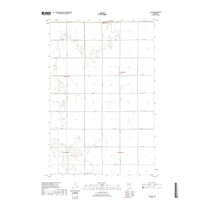
2019 Map of Ada NW
USGS Topo · Published 2019About this map
The Marsh River meanders across the southern portion of this landscape, marking a sharp contrast to the straight, engineered lines of the local irrigation network. In this corner of the Red River Valley, the Judicial Ditch Number Fifty Three illustrates the intensive drainage efforts required to transform this region into productive farmland. The map records the precise boundary between Polk County and Norman County, where the rigid grid of county roads and section lines defines the agricultural settlement pattern. For those researching local heritage, the inclusion of Bethany Cemetery provides a specific point of reference in an otherwise broad expanse of field and prairie. This survey reflects the modern agricultural era, showing how water management and township divisions continue to shape the character of the Minnesota plains.
Find a feature on this map
27 named features on this map. Tap any name to fly to it.
Don’t see what you’re looking for? This feature index may not catch every label — zoom into the map to look around manually.
Map Details
Editions of this 2019 Ada NW Map
This is the sole edition of this map. No revisions or reprints were ever made.
Other maps of this area

1918 · Hendrum
USGS Topo · 1:62,500

1919 · Eldred
USGS Topo · 1:62,500

1919 · Beltrami
USGS Topo · 1:62,500

1924 · Ada
USGS Topo · 1:62,500

1952 · Grand Forks
USGS Topo · 1:250,000

1956 · Grand Forks
USGS Topo · 1:250,000

1963 · Shelly
USGS Topo · 1:24,000

1963 · Halstad
USGS Topo · 1:24,000

1964 · Beltrami
USGS Topo · 1:24,000

1964 · Beltrami SW
USGS Topo · 1:24,000