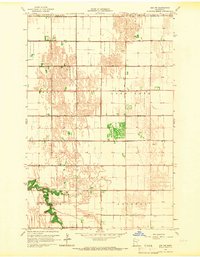
1965 Map of Ada NW
USGS Topo · Published 1966About this map
The Marsh River meanders through the southwestern corner of this landscape, its natural course contrasting sharply with the rigid network of agricultural drainage that defines the region. This 1965 survey illustrates the extensive efforts to manage the Red River Valley plains through systems like Judicial Ditch No 52, Judicial Ditch No 53, and County Ditch No 64. These engineered waterways follow section lines, supporting the expansive farm plots of townships such as Good Hope, Shelly, and Halstad.
Find a feature on this map
15 named features on this map. Tap any name to fly to it.
Don’t see what you’re looking for? This feature index may not catch every label — zoom into the map to look around manually.
Map Details
Editions of this 1965 Ada NW Map
This is the sole edition of this map. No revisions or reprints were ever made.
Other maps of this area

1918 · Hendrum
USGS Topo · 1:62,500

1919 · Eldred
USGS Topo · 1:62,500

1919 · Beltrami
USGS Topo · 1:62,500

1924 · Ada
USGS Topo · 1:62,500

1952 · Grand Forks
USGS Topo · 1:250,000

1956 · Grand Forks
USGS Topo · 1:250,000

1963 · Shelly
USGS Topo · 1:24,000

1963 · Halstad
USGS Topo · 1:24,000

1964 · Beltrami
USGS Topo · 1:24,000

1964 · Beltrami SW
USGS Topo · 1:24,000