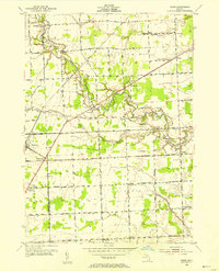
1952 Map of Adair
USGS Topo · Published 1954About this map
The Belle River meanders through the heart of the St. Clair County countryside, defining a landscape of agricultural sections and scattered small settlements in the early 1950s. This survey records a transition in rural education, preserving the locations of numerous district schoolhouses such as Pink Sch, Bunker Sch, and Porrett Sch, while others like Hunt Sch and Claggett Sch are already noted as abandoned. The village of Richmond sits at the western edge of the quadrangle, with the small community of Muttonville just to its south along Gratiot Road.
Find a feature on this map
60 named features on this map. Tap any name to fly to it.
Don’t see what you’re looking for? This feature index may not catch every label — zoom into the map to look around manually.
Map Details
Editions of this 1952 Adair Map
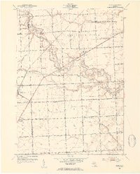
2 editions found
Other maps of this area

1912 · Mt Clemens
USGS Topo · 1:62,500

1914 · Armada
USGS Topo · 1:62,500

1914 · Algonac
USGS Topo · 1:62,500

1928 · Armada
USGS Topo · 1:62,500

1928 · Hicky
USGS Topo · 1:62,500

1929 · Mt Clemens
USGS Topo · 1:62,500

1936 · New Haven
USGS Topo · 1:31,680

1936 · Rattle Run
USGS Topo · 1:31,680

1936 · New Baltimore
USGS Topo · 1:31,680

1939 · New Baltimore
USGS Topo · 1:24,000