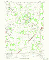
1968 Map of Adair
USGS Topo · Published 1971About this map
The Belle River meanders across the agricultural heart of Columbus and Casco townships, anchoring a landscape defined by the intersection of rural life and natural resources in the late 1960s. The village of Richmond and the nearby settlement of Muttonville sit along the western edge, where Macomb and St. Clair counties meet. This survey shows the extensive rural grid of roads named for local families, such as Kroner Rd and Hessen Rd, which connect quiet hamlets like Adair and Snyderville.
Find a feature on this map
64 named features on this map. Tap any name to fly to it.
Don’t see what you’re looking for? This feature index may not catch every label — zoom into the map to look around manually.
Map Details
Editions of this 1968 Adair Map
3 editions found
Other maps of this area

1912 · Mt Clemens
USGS Topo · 1:62,500

1914 · Armada
USGS Topo · 1:62,500

1914 · Algonac
USGS Topo · 1:62,500

1928 · Armada
USGS Topo · 1:62,500

1928 · Hicky
USGS Topo · 1:62,500

1929 · Mt Clemens
USGS Topo · 1:62,500

1936 · New Haven
USGS Topo · 1:31,680

1936 · Rattle Run
USGS Topo · 1:31,680

1936 · New Baltimore
USGS Topo · 1:31,680

1939 · New Baltimore
USGS Topo · 1:24,000