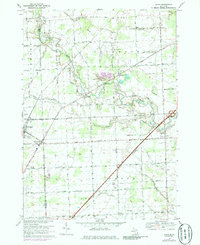
1968 Map of Adair
USGS Topo · Published 1986About this map
The Belle River meanders across the St. Clair County countryside, defining the rural character of Columbus and Casco townships. This late-1960s landscape is a study in transitional land use, where long-established agricultural plots sit atop the productive Columbus Gas Field and the Puttygut Oil and Gas Field. Small crossroads settlements like Adair and Snyderville serve as local hubs, while Richmond and Muttonville sit along the western boundary near the Macomb and St. Clair County line.
Find a feature on this map
48 named features on this map. Tap any name to fly to it.
Don’t see what you’re looking for? This feature index may not catch every label — zoom into the map to look around manually.
Map Details
Editions of this 1968 Adair Map
3 editions found
Other maps of this area

1912 · Mt Clemens
USGS Topo · 1:62,500

1914 · Armada
USGS Topo · 1:62,500

1914 · Algonac
USGS Topo · 1:62,500

1928 · Armada
USGS Topo · 1:62,500

1928 · Hicky
USGS Topo · 1:62,500

1929 · Mt Clemens
USGS Topo · 1:62,500

1936 · New Haven
USGS Topo · 1:31,680

1936 · Rattle Run
USGS Topo · 1:31,680

1936 · New Baltimore
USGS Topo · 1:31,680

1939 · New Baltimore
USGS Topo · 1:24,000