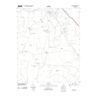
2011 Map of Adairsville
USGS Topo · Published 2011About this map
Adairsville serves as the central hub of this Bartow County landscape, where the Adairsville Post Office and Adairsville Quarry anchor the local economy and infrastructure. The map reveals a dense network of family-named landmarks and rural congregations, reflecting a long-standing community structure. Significant genealogical sites include the Barnsley Family Cemetery at the Barnsley Gardens estate, as well as the Stoner Chapel Cemetery and Spring Bank Cemetery. The terrain is defined by a series of prominent peaks, including Snow Springs Mountain, Wolf Cave Mountain, and Connesena Mountain, which dictate the winding paths of watercourses like Oothkalooga Creek and Connesena Creek. This modern survey documents the established settlements of Halls, Snow Springs, and Cement, alongside specialized features such as Caseys North Lake and Lake Margarete.
Find a feature on this map
106 named features on this map. Tap any name to fly to it.
Don’t see what you’re looking for? This feature index may not catch every label — zoom into the map to look around manually.
Map Details
Editions of this 2011 Adairsville Map
This is the sole edition of this map. No revisions or reprints were ever made.
Other maps of this area

1886 · Rome
USGS Topo · 1:125,000

1890 · Cartersville
USGS Topo · 1:125,000

1891 · Cartersville
USGS Topo · 1:125,000

1896 · Cartersville
USGS Topo · 1:125,000

1898 · Rome
USGS Topo · 1:125,000

1899 · Rome
USGS Topo · 1:125,000

1904 · Rome
USGS Topo · 1:125,000

1906 · Stilesboro
USGS Topo · 1:62,500

1908 · Stilesboro
USGS Topo · 1:62,500

1941 · Adairsville
USGS Topo · 1:62,500