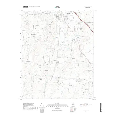
2020 Map of Adairsville
USGS Topo · Published 2020About this map
Adairsville serves as the focal point of this northern Bartow County landscape, where the CSX railroad corridor parallels the historic town center. The surrounding terrain is defined by a series of prominent peaks and ridges, including Connesena Mtn, Henderson Mtn, and Wolf Cave Mtn, which separate the agricultural valleys. For genealogists and local historians, the map is remarkably dense with family-named landmarks and small community centers like Halls and Snow Springs. Numerous family burial grounds are recorded, such as the James M Shaw Family Cem and Barnsley Family Cem, alongside established congregations like the Mount Carmel Methodist Church. Water features like Oothkalooga Cr and Connesena Cr wind through the lowlands, supporting the rural settlements and local industry, including a Gravel Pit located near the town of Adairsville.
Find a feature on this map
133 named features on this map. Tap any name to fly to it.
Don’t see what you’re looking for? This feature index may not catch every label — zoom into the map to look around manually.
Map Details
Editions of this 2020 Adairsville Map
This is the sole edition of this map. No revisions or reprints were ever made.
Other maps of this area

1886 · Rome
USGS Topo · 1:125,000

1890 · Cartersville
USGS Topo · 1:125,000

1891 · Cartersville
USGS Topo · 1:125,000

1896 · Cartersville
USGS Topo · 1:125,000

1898 · Rome
USGS Topo · 1:125,000

1899 · Rome
USGS Topo · 1:125,000

1904 · Rome
USGS Topo · 1:125,000

1906 · Stilesboro
USGS Topo · 1:62,500

1908 · Stilesboro
USGS Topo · 1:62,500

1941 · Adairsville
USGS Topo · 1:62,500