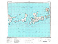
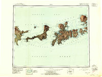
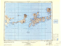
1983 Map of Adak
USGS Topo · Published 1984About this map
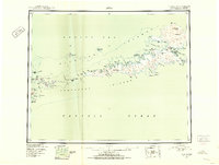
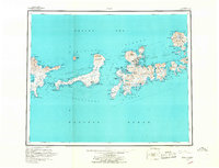
Adak Naval Station serves as the focal point of human activity on this island landscape, representing a critical Cold War outpost in the Aleutian chain. The settlement at Adak is situated between the high peaks of Mount Moffett and Mount Adagdak, overlooking the strategic waters of Kuluk Bay. This 1983 revision shows the complex infrastructure of the Military Airport and the Loran Sta, reflecting the importance of communications and aerial surveillance during this era. The map delineates the Aleutian Islands Wilderness, which covers the majority of the landmass south of the base. Water bodies like Finger Bay, Shagak Bay, and Andrew Lake dominate the geography, while smaller landmarks such as the Cem and Farm indicate the diverse, albeit sparse, footprints of residence and service on the island. The survey captures the intricate coastline of the northern and central portions of the island before the base underwent significant downsizing in the late twentieth century.
Find a feature on this map
170 named features on this map. Tap any name to fly to it.
Don’t see what you’re looking for? This feature index may not catch every label — zoom into the map to look around manually.
Map Details
Editions of this 1983 Adak Map
This is the sole edition of this map. No revisions or reprints were ever made.
Other maps of this area

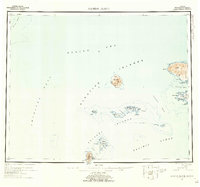
1951 · Gareloi Island
USGS Topo · 1:250,000
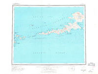
1951 · Adak
USGS Topo · 1:250,000
1952 · Atka
USGS Topo · 1:250,000
1954 · Adak
USGS Topo · 1:250,000
1954 · Gareloi Island
USGS Topo · 1:250,000
1957 · Adak
USGS Topo · 1:250,000
1959 · Atka
USGS Topo · 1:250,000
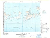
1967 · Adak
USGS Topo · 1:250,000

2021 · Adak D-1 SW
USGS Topo · 1:25,000

2021 · Atka C-6 SW
USGS Topo · 1:25,000