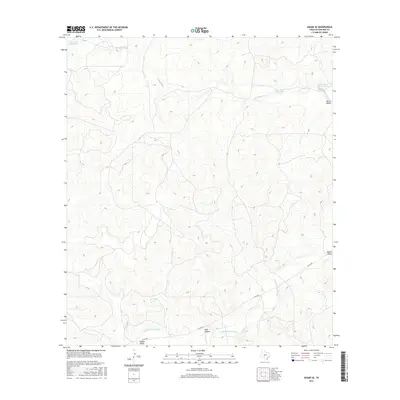
2016 Map of Adams SE
USGS Topo · Published 2016About this map
Eightmile Waterhole and other vital water sources define the drainage patterns of this Schleicher County landscape. In a region where reliable water is essential for ranching and agriculture, features such as Twelvemile Waterhole and Panther Bluff Waterhole serve as critical landmarks. The map details the branching paths of the N Valley Prong and Middle Valley Prong, which carve out the distinct topographies of North Valley and Middle Valley. The presence of Bull Hollow and the transit route of Co RD 245 highlight the intersection of natural terrain and local infrastructure, showing how land use and movement are dictated by the underlying hydrology of the Texas Edwards Plateau.
Find a feature on this map
9 named features on this map. Tap any name to fly to it.
Don’t see what you’re looking for? This feature index may not catch every label — zoom into the map to look around manually.
Map Details
Editions of this 2016 Adams SE Map
This is the sole edition of this map. No revisions or reprints were ever made.
Other maps of this area

1893 · Fort McKavett
USGS Topo · 1:125,000

1954 · Sonora
USGS Topo · 1:250,000

1958 · Sonora
USGS Topo · 1:250,000

1963 · Buffalo Well
USGS Topo · 1:24,000

1963 · Buffalo Well NW
USGS Topo · 1:24,000

1963 · Adams
USGS Topo · 1:24,000

1963 · Adams NW
USGS Topo · 1:24,000

1963 · Adams SE
USGS Topo · 1:24,000

1963 · Adams SW
USGS Topo · 1:24,000
1963 · Coal Kiln Draw
USGS Topo · 1:24,000