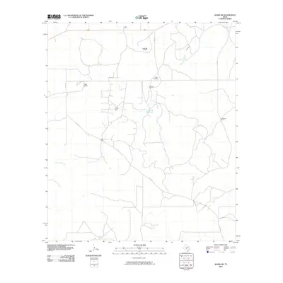
2010 Map of Adams SW
USGS Topo · Published 2010About this map
Page Oil and Gas Field serves as a prominent industrial landmark within this expansive Schleicher County landscape, illustrating the regional importance of resource extraction in the early 21st century. The terrain is defined by low-lying drainages and ephemeral water sources, most notably the Twentymile Waterhole and the North Valley Prong. Unlike more densely populated regions, this area is characterized by large private holdings and family-named livestock operations, including Koy Ranch in the north and Henderson Ranch near the center of the quadrangle. A network of county roads, such as Co RD 220 and Co RD 224, connects these remote outposts. The map reveals a land structured by the requirements of ranching and energy, where significant geographic features like Live Oak Hollow and Lake Hollow provide critical context for the local water table and grazing patterns.
Find a feature on this map
15 named features on this map. Tap any name to fly to it.
Don’t see what you’re looking for? This feature index may not catch every label — zoom into the map to look around manually.
Map Details
Editions of this 2010 Adams SW Map
This is the sole edition of this map. No revisions or reprints were ever made.
Other maps of this area

1893 · Fort McKavett
USGS Topo · 1:125,000

1954 · Sonora
USGS Topo · 1:250,000

1958 · Sonora
USGS Topo · 1:250,000

1963 · Buffalo Well
USGS Topo · 1:24,000

1963 · Buffalo Well NW
USGS Topo · 1:24,000

1963 · Adams
USGS Topo · 1:24,000

1963 · Adams NW
USGS Topo · 1:24,000

1963 · Adams SE
USGS Topo · 1:24,000

1963 · Adams SW
USGS Topo · 1:24,000

1964 · Sonora NE
USGS Topo · 1:24,000