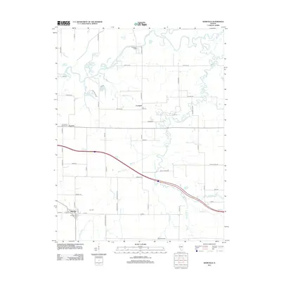
2012 Map of Addieville
USGS Topo · Published 2012About this map
The Kaskaskia River snakes across this terrain, defining a landscape of oxbow lakes and wetlands such as Big Forked Lake, Wildcat Lake, and Horseshoe Lake. The settlement of Addieville anchors the southwest corner of the sheet, where residential streets like W 3rd St and E 151 St meet at the local Addieville Cem. This part of Washington County is characterized by its rural road network, with many routes named after local wildlife, including Bluebird Rd, Chickadee Rd, and Bobwhite Rd.
Find a feature on this map
74 named features on this map. Tap any name to fly to it.
Don’t see what you’re looking for? This feature index may not catch every label — zoom into the map to look around manually.
Map Details
Editions of this 2012 Addieville Map
This is the sole edition of this map. No revisions or reprints were ever made.
Other maps of this area

1906 · Breese
USGS Topo · 1:62,500

1907 · Breese
USGS Topo · 1:62,500

1910 · Carlyle
USGS Topo · 1:62,500

1910 · Okawville
USGS Topo · 1:62,500

1931 · Hoyleton
USGS Topo · 1:48,000

1932 · Nashville
USGS Topo · 1:62,500

1936 · Nashville
USGS Topo · 1:62,500

1940 · Okawville
USGS Topo · 1:62,500

1948 · Carlyle
USGS Topo · 1:62,500

1958 · Belleville
USGS Topo · 1:250,000