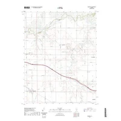
2021 Map of Addieville
USGS Topo · Published 2021About this map
Addieville and New Minden anchor this portion of Washington County, where the agricultural landscape is defined by the winding course of Crooked Creek and the Kaskaskia River. The northern reaches are notably wetland-heavy, featuring a cluster of named water bodies including Big Flat Lake, Turkey Lake, and Wildcat Lake. This area reflects a long-standing settlement pattern where small villages like Covington and Frogtown are connected by a network of rural roads, many named for local birds such as Bluebird RD and Bobwhite RD. Genealogists will find significant value in the distribution of community burial sites, from the Olive Branch Cem near the western border to the Lively Cem and Saint Lukes Cem further east. The transition from the alluvial bottomlands of North Prairie to the riparian corridors of Beaver Pond Cr and Little Crooked Creek illustrates the intricate drainage system critical to the region's farming heritage.
Find a feature on this map
73 named features on this map. Tap any name to fly to it.
Don’t see what you’re looking for? This feature index may not catch every label — zoom into the map to look around manually.
Map Details
Editions of this 2021 Addieville Map
This is the sole edition of this map. No revisions or reprints were ever made.
Other maps of this area

1906 · Breese
USGS Topo · 1:62,500

1907 · Breese
USGS Topo · 1:62,500

1910 · Carlyle
USGS Topo · 1:62,500

1910 · Okawville
USGS Topo · 1:62,500

1931 · Hoyleton
USGS Topo · 1:48,000

1932 · Nashville
USGS Topo · 1:62,500

1936 · Nashville
USGS Topo · 1:62,500

1940 · Okawville
USGS Topo · 1:62,500

1948 · Carlyle
USGS Topo · 1:62,500

1958 · Belleville
USGS Topo · 1:250,000