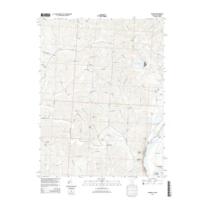
2013 Map of Addison
USGS Topo · Published 2013About this map
The Ohio River shoreline defines the eastern boundary of this area, where historical river access points like Machir Landing and Berrys Landing speak to a long history of water-based transport. Near the northern bend of the river, industrial activity is marked by the presence of the Gavin Fly Ash Impoundment and the Gavin Bottom Ash Pond, contrasting with the surrounding rural terrain. The landscape is characterized by numerous small ridges and hollows, such as Swisher Ridge, Oil Hollow, and Honey Hollow, which have historically dictated the placement of small communities and family farmsteads.
Find a feature on this map
106 named features on this map. Tap any name to fly to it.
Don’t see what you’re looking for? This feature index may not catch every label — zoom into the map to look around manually.
Map Details
Editions of this 2013 Addison Map
This is the sole edition of this map. No revisions or reprints were ever made.
Other maps of this area

1905 · Wilkesville
USGS Topo · 1:62,500

1906 · Bidwell
USGS Topo · 1:62,500

1907 · Pomeroy
USGS Topo · 1:62,500

1908 · Bidwell
USGS Topo · 1:62,500

1908 · Point Pleasant
USGS Topo · 1:62,500

1908 · Wilkesville
USGS Topo · 1:62,500

1926 · Point Pleasant
USGS Topo · 1:62,500

1929 · Point Pleasant
USGS Topo · 1:62,500

1947 · Columbus
USGS Topo · 1:250,000

1957 · Beech Hill
USGS Topo · 1:24,000