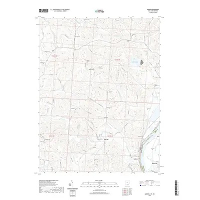
2019 Map of Addison
USGS Topo · Published 2019About this map
Addison and Bellmeade occupy the riverbank along the Ohio River as it forms the state boundary between Ohio and West Virginia. This landscape is defined by the steep hollows and ridges rising from the river valley, where small rural communities like Bulaville, Kyger, and Eno are connected by a network of winding township roads. The map illustrates the industrial footprint of the region through large-scale features such as the Gavin-Fly Ash Impoundment and the Gavin Bottom Ash Pond, which stand in contrast to the numerous traditional burial grounds dotting the hillsides, including Van Zant, Halthill, and Lemley. Genealogists may find particular value in the distribution of family-named landmarks such as Moore, McCarty, and Lewis cemeteries, which offer a look at the ancestral settlement patterns of this river-border region.
Find a feature on this map
109 named features on this map. Tap any name to fly to it.
Don’t see what you’re looking for? This feature index may not catch every label — zoom into the map to look around manually.
Map Details
Editions of this 2019 Addison Map
This is the sole edition of this map. No revisions or reprints were ever made.
Other maps of this area

1905 · Wilkesville
USGS Topo · 1:62,500

1906 · Bidwell
USGS Topo · 1:62,500

1907 · Pomeroy
USGS Topo · 1:62,500

1908 · Bidwell
USGS Topo · 1:62,500

1908 · Point Pleasant
USGS Topo · 1:62,500

1908 · Wilkesville
USGS Topo · 1:62,500

1926 · Point Pleasant
USGS Topo · 1:62,500

1929 · Point Pleasant
USGS Topo · 1:62,500

1947 · Columbus
USGS Topo · 1:250,000

1957 · Beech Hill
USGS Topo · 1:24,000