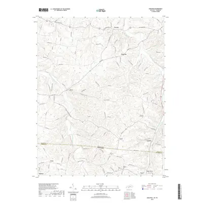
2019 Map of Adolphus
USGS Topo · Published 2019About this map
Adolphus and Sugar Grove anchor this 2019 survey along the Kentucky-Tennessee border, where the rural uplands are dissected by the Middle Fork Drakes Creek and Trammel Creek drainage systems. The landscape is characterized by narrow ridge-top roads and small settlements that historically served the agricultural and timber interests of the region. The map reveals a high concentration of community burial sites and churches, including Mount Olive Cem and Roberts Tabernacle Cem, which are vital landmarks for genealogical research in this borderland area.
Find a feature on this map
110 named features on this map. Tap any name to fly to it.
Don’t see what you’re looking for? This feature index may not catch every label — zoom into the map to look around manually.
Map Details
Editions of this 2019 Adolphus Map
This is the sole edition of this map. No revisions or reprints were ever made.
Other maps of this area

1921 · Bowling Green
USGS Topo · 1:62,500

1923 · Bowling Green
USGS Topo · 1:62,500

1926 · Scottsville
USGS Topo · 1:62,500

1928 · Adolphus
USGS Topo · 1:48,000

1931 · Lafayette
USGS Topo · 1:62,500

1931 · Adolphus
USGS Topo · 1:62,500

1942 · Gallatin
USGS Topo · 1:100,000

1954 · Drake
USGS Topo · 1:24,000

1954 · Petroleum
USGS Topo · 1:24,000

1954 · Scottsville
USGS Topo · 1:24,000