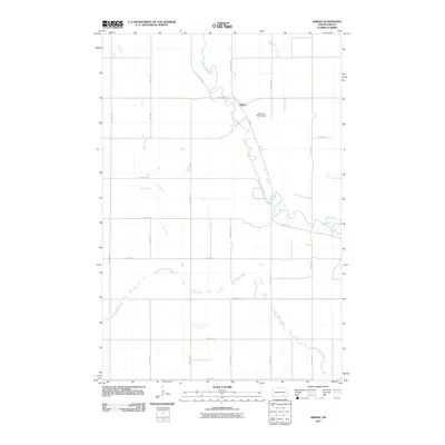
2011 Map of Adrian
USGS Topo · Published 2011About this map
Adrian sits along the winding course of the James River in this 2011 survey, serving as a focal point for the surrounding agricultural landscape of LaMoure County. The map documents the intricate river hydrology and its interaction with local infrastructure, most notably at the Heinrich-Martin Dam located just east of the settlement. The drainage patterns of the prairie are clearly defined by the paths of Dry Creek to the west and Bone Hill Creek to the south, both of which feed toward the primary river valley.
Find a feature on this map
21 named features on this map. Tap any name to fly to it.
Don’t see what you’re looking for? This feature index may not catch every label — zoom into the map to look around manually.
Map Details
Editions of this 2011 Adrian Map
This is the sole edition of this map. No revisions or reprints were ever made.
Other maps of this area

1894 · La Moure
USGS Topo · 1:62,500

1895 · Lamoure
USGS Topo · 1:125,000

1896 · Jamestown
USGS Topo · 1:125,000

1896 · Edgeley
USGS Topo · 1:125,000

1897 · Eckelson
USGS Topo · 1:125,000

1918 · La Moure
USGS Topo · 1:125,000

1925 · Edgeley
USGS Topo · 1:125,000

1952 · Dickey
USGS Topo · 1:24,000

1953 · Jamestown
USGS Topo · 1:250,000

1953 · Montpelier
USGS Topo · 1:24,000