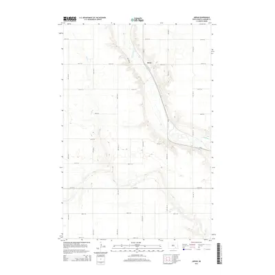
2014 Map of Adrian
USGS Topo · Published 2014About this map
The James River winds through the heart of the North Dakota prairie, carving a distinct valley that defines the landscape around the small settlement of Adrian. This 2014 survey illustrates the region's agricultural grid, where a network of section roads like 89th Ave SE and 56th St SE crisscross the plains. The terrain is further shaped by the intermittent drainage of Dry Creek, which meanders from the west toward the river basin. The map highlights the intersection of local infrastructure and natural waterways, notably where CR-63 follows the ridge line and enters the river valley. The placement of the namesake townsite relative to these geographical markers offers a clear view of how water sources and transportation routes dictated the development of these rural communities.
Find a feature on this map
20 named features on this map. Tap any name to fly to it.
Don’t see what you’re looking for? This feature index may not catch every label — zoom into the map to look around manually.
Map Details
Editions of this 2014 Adrian Map
This is the sole edition of this map. No revisions or reprints were ever made.
Other maps of this area

1894 · La Moure
USGS Topo · 1:62,500

1895 · Lamoure
USGS Topo · 1:125,000

1896 · Jamestown
USGS Topo · 1:125,000

1896 · Edgeley
USGS Topo · 1:125,000

1897 · Eckelson
USGS Topo · 1:125,000

1918 · La Moure
USGS Topo · 1:125,000

1925 · Edgeley
USGS Topo · 1:125,000

1952 · Dickey
USGS Topo · 1:24,000

1953 · Jamestown
USGS Topo · 1:250,000

1953 · Montpelier
USGS Topo · 1:24,000