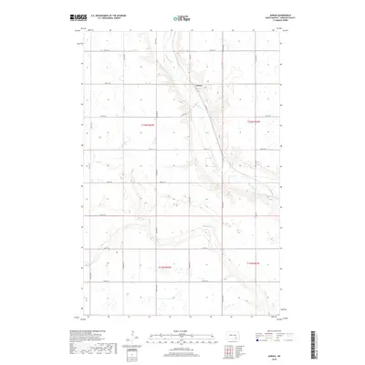
2018 Map of Adrian
USGS Topo · Published 2018About this map
The settlement of Adrian serves as a focal point in this section of LaMoure County, situated near the winding course of the James River. This North Dakota prairie landscape is defined by the agricultural grid of townships T136N R63W and T135N R63W, where the land is cut by the seasonal drainage of Dry Cr. The layout of the region shows a transition between the elevated plains and the river valley, with section lines and local roads connecting the sparse farmsteads that characterize this rural geography. Modern mapping techniques from the U.S. Geological Survey illustrate the precise elevation contours and the network of wetlands that punctuate the fields, reflecting the hydrology of the James River basin.
Find a feature on this map
2 named features on this map. Tap any name to fly to it.
Don’t see what you’re looking for? This feature index may not catch every label — zoom into the map to look around manually.
Map Details
Editions of this 2018 Adrian Map
This is the sole edition of this map. No revisions or reprints were ever made.
Other maps of this area

1894 · La Moure
USGS Topo · 1:62,500

1895 · Lamoure
USGS Topo · 1:125,000

1896 · Jamestown
USGS Topo · 1:125,000

1896 · Edgeley
USGS Topo · 1:125,000

1897 · Eckelson
USGS Topo · 1:125,000

1918 · La Moure
USGS Topo · 1:125,000

1925 · Edgeley
USGS Topo · 1:125,000

1952 · Dickey
USGS Topo · 1:24,000

1953 · Jamestown
USGS Topo · 1:250,000

1953 · Montpelier
USGS Topo · 1:24,000