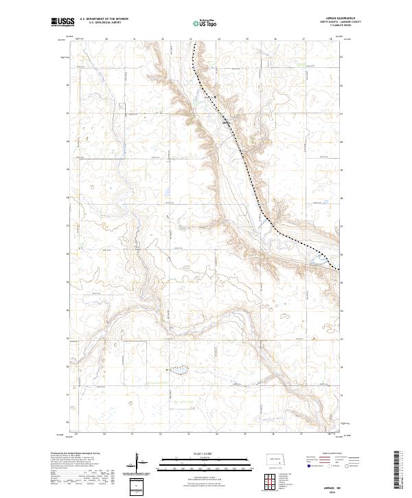
2024 Map of Adrian
USGS Topo · Published 2024About this map
The settlement of Adrian sits within a landscape defined by the winding course of the James River and its tributary, Dry Creek. This 2024 map documents the rural character of northern LaMoure County, where the valley floor transitions into a geometric grid of section lines and gravel routes such as Co Rd 63 and 56th St SE. The map provides specific locational data for researchers interested in local landmarks like Adrian Cem, which overlooks the river valley from a nearby ridge.
Find a feature on this map
25 named features on this map. Tap any name to fly to it.
Don’t see what you’re looking for? This feature index may not catch every label — zoom into the map to look around manually.
Map Details
Editions of this 2024 Adrian Map
This is the sole edition of this map. No revisions or reprints were ever made.
Other maps of this area

1894 · La Moure
USGS Topo · 1:62,500

1895 · Lamoure
USGS Topo · 1:125,000

1896 · Jamestown
USGS Topo · 1:125,000

1896 · Edgeley
USGS Topo · 1:125,000

1897 · Eckelson
USGS Topo · 1:125,000

1918 · La Moure
USGS Topo · 1:125,000

1925 · Edgeley
USGS Topo · 1:125,000

1952 · Dickey
USGS Topo · 1:24,000

1953 · Jamestown
USGS Topo · 1:250,000

1953 · Montpelier
USGS Topo · 1:24,000