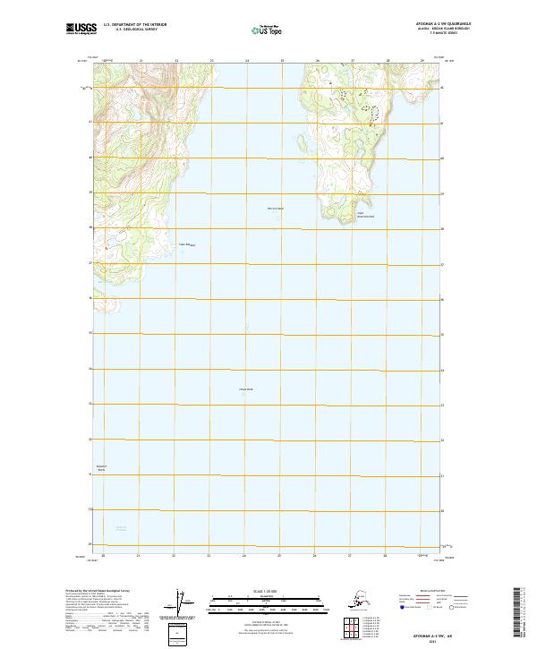
2021 Map of Afognak A-2 SW
USGS Topo · Published 2021About this map
Cape Kazakof and the surrounding waters of Kodiak Island define this maritime landscape in the early twenty-first century. This survey documents a critical intersection of sea and stone, where the rugged coastline transitions from the sheltered waters of Marka Bay to the open stretches of the Eastern Passage. The nautical environment is further characterized by navigational hazards and coastal markers such as Skipwith Reefs and the prominent Stripe Rock, which sit within the tide-swept reaches south of Parrot Island. To the northeast, the shoreline extends toward Cape Kostromitinof, illustrating the complex coastal geometry of the Alaskan archipelago. The map serves as a contemporary record of these uninhabited landforms, providing precise topographic and hydrographic data for the numerous capes and passages that have long dictated the movement of vessels through these northern waters.
Find a feature on this map
11 named features on this map. Tap any name to fly to it.
Don’t see what you’re looking for? This feature index may not catch every label — zoom into the map to look around manually.
Map Details
Editions of this 2021 Afognak A-2 SW Map
This is the sole edition of this map. No revisions or reprints were ever made.
Other maps of this area

1947 · Kodiak D-3
USGS Topo · 1:63,360

1949 · Kodiak D-2
USGS Topo · 1:63,360

1949 · Kodiak D-3
USGS Topo · 1:63,360

1950 · Kodiak D-3
USGS Topo · 1:63,360

1951 · Kodiak D-2
USGS Topo · 1:63,360

1952 · Kodiak
USGS Topo · 1:250,000

1952 · Afognak
USGS Topo · 1:250,000

1952 · Afognak A-3
USGS Topo · 1:63,360

1952 · Afognak A-2
USGS Topo · 1:63,360
1954 · Afognak A-2
USGS Topo · 1:63,360